Welcome To XploristNet!
Your Exploration Journey Starts Here
Featured Places
View More
Discover hundreds of hidden places
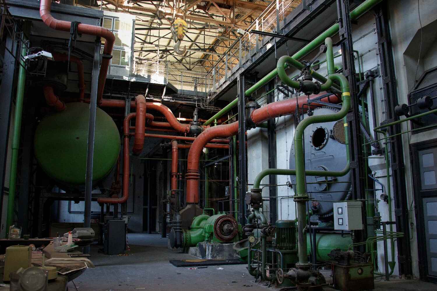
Power Plant
#KRPLNThis is one of the oldest lignite power plants in Europe, dating back to the 1920s.
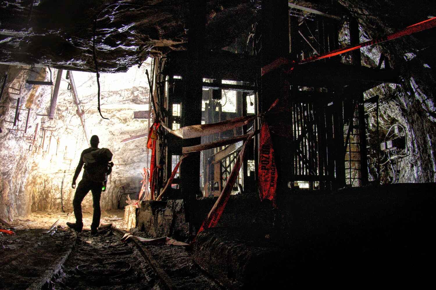
Coal Mine
#UODPAA tunnel network longer than 400 kilometers, shafts that drop down multiple hundred meters.
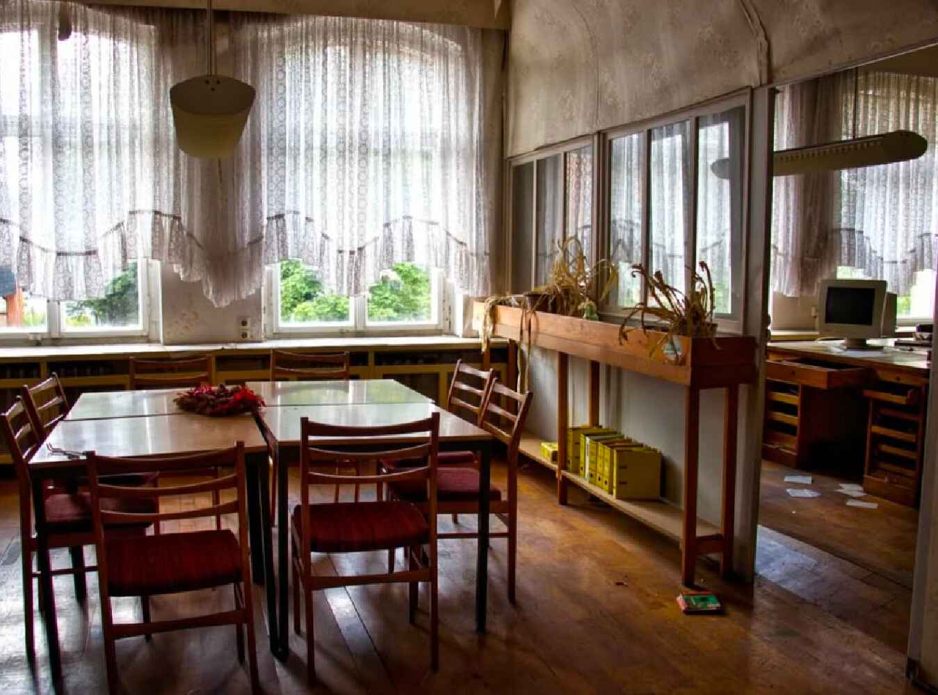
Old Factory With Power
#PGWQOThis factory has been abandoned for a very long time now - however, the power is still on.
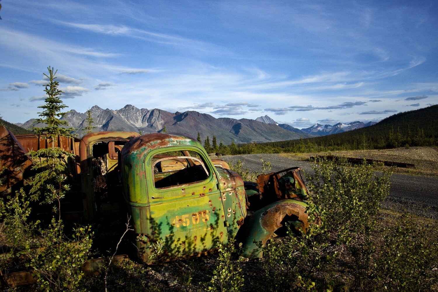
Army Truck Graveyard
#MCVHTThis spot definitely isn't for the faint-hearted! It lies so remote in the Canadian wilderness.
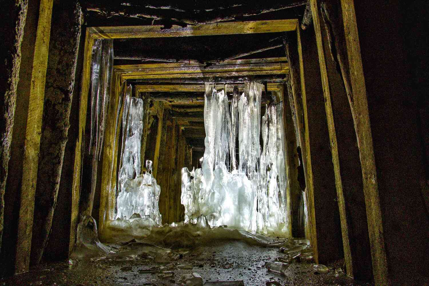
Frozen Mine
#GNCOSIn some mountains in the far up North, you can find an entrance to underground tunnels that are completely frozen!
View More
Discover hundreds of hidden places
Uncover The Hidden
Uncover abandoned locations and other spots off the beaten path. XploristNet features an interactive map filled with hundreds of forgotten and lesser-known places. Share your photos, connect with like-minded adventurers, and expand your discovery list.
Interactive Map
Explore abandoned and hidden locations worldwide
Connect with Explorers
Join a community of fellow adventurers
Share Your Adventures
Upload photos and document your discoveries
Earn Points
Get rewarded for sharing new places
Search & Filter
Easily find locations that match your interests
Save & Share Lists
Save your own places and share location lists with others
Start Your Journey
Join hundreds of explorers discovering hidden gems around the world
Alternative Ways to Get XploristNet
Explore all available download options and platforms